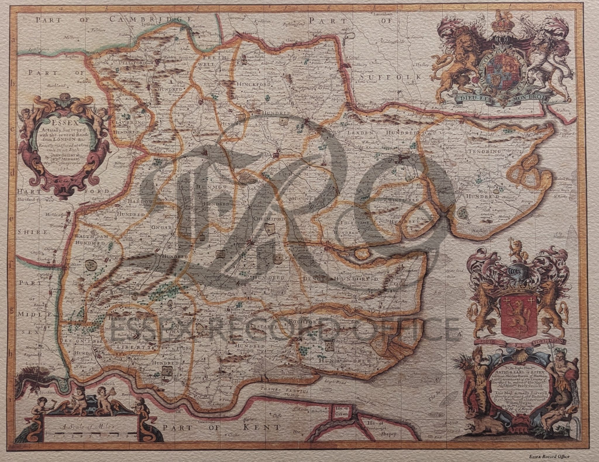
John Ogilby & William Morgan’s map of Essex – 1678
$33.01
$59.75
Description Printed reproduction of Ogilby & Morgan’s map of Essex created in 1678. ‘Essex Actually Surveyed with the several Roads from London &c. Exactly measured at three mile in an Inch By John Ogilby & Wilm Morgan His Majties Cosmographers 1678’ Shows main roads with junctions of secondary roads distinguishing between enclosed and open, a few of the larger houses, parks, heaths, windmills, land and sea beacons, also marshes and sandbanks. Finely engraved cartouches enclosing title and dedication, the latter flanked with figures of Ceres and Neptune. Ornate achievements of the royal arms and those of Capel, Earl of Essex. Scale surmounted by cherubs holding a square, astrolabe, sextant and dividers. Five mile squares, defined by letters across the top and down the left hand side. No latitude, longitude or compass rose. Coloured. The scale of the reproduction may not match that of the original 24″ x 27″